Mapping Projects Since 2024
Here are a few featured projects I’ve worked on in the past few years. In the Medium article I discuss how I got started using DuckDB and the Fused.io platform. The projects vary from heatmaps with building footprint data from Overture Maps via Source Cooperative to remote sensing with open source options such as Landsat and Sentinel-2. I often use DuckDB with the H3 Extension. Most of the code from these projects is available on GitHub: fused_udfs · duckdb_h3.
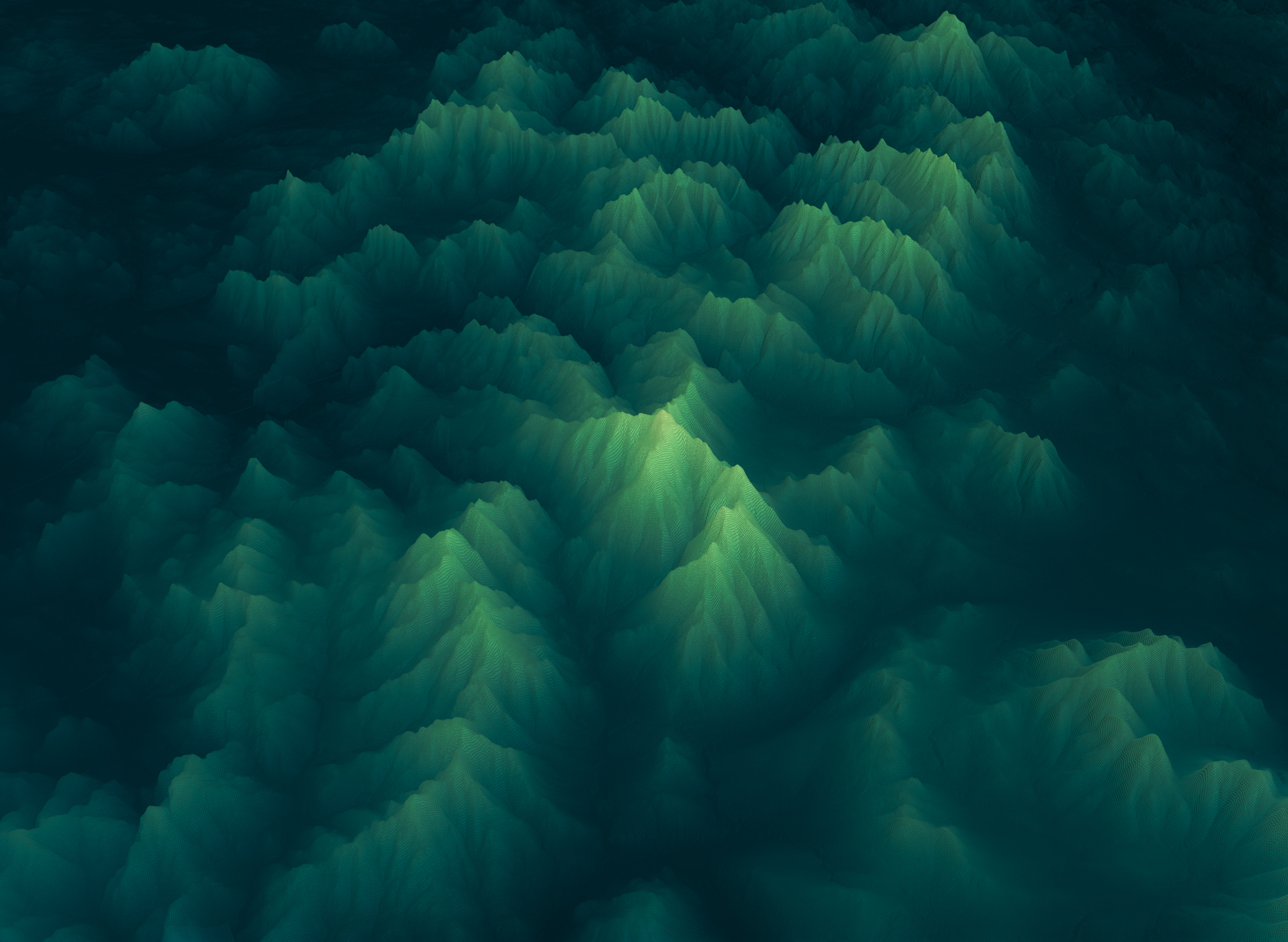
White Mountains, New Hampshire — Presidential Range, 10m DEM, H3
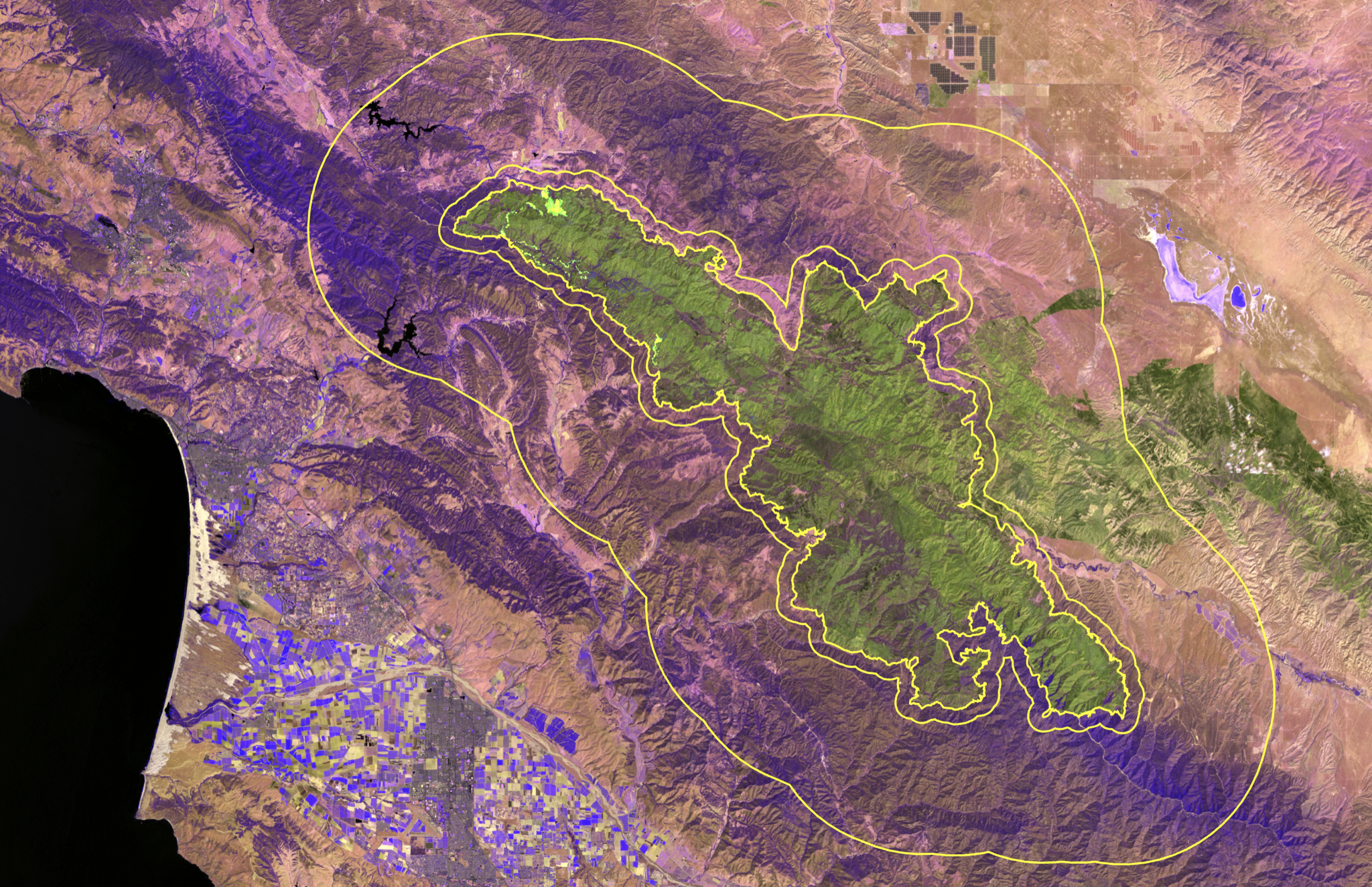
Southern California — HLS Burn Scar with Perimeter Lines
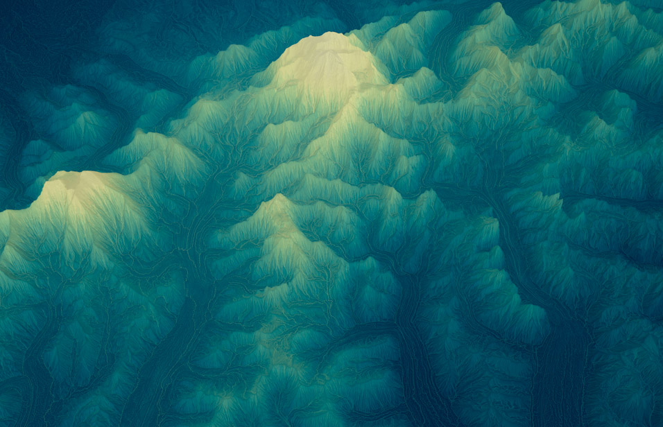
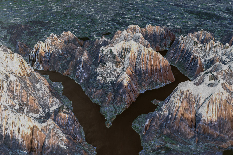
Mount Denali, Alaska — IFSAR DEM, H3 Elevation, WBT Flow Accumulation
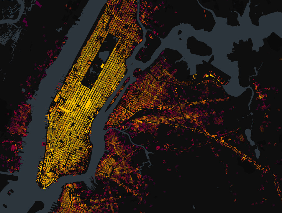
New York City — TLC Cab Pickups Joined to Overture Buildings
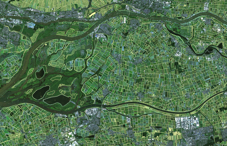
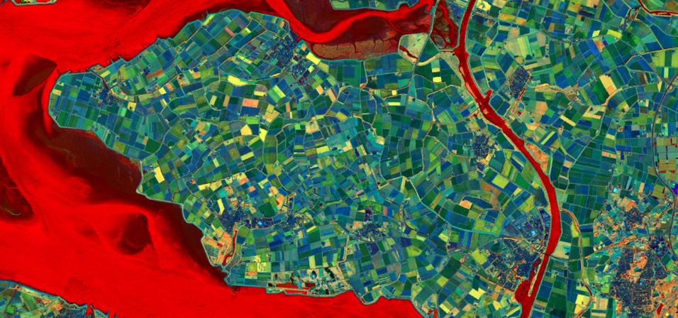
Netherlands — fiboa Agricultural Field Boundaries over Sentinel-2
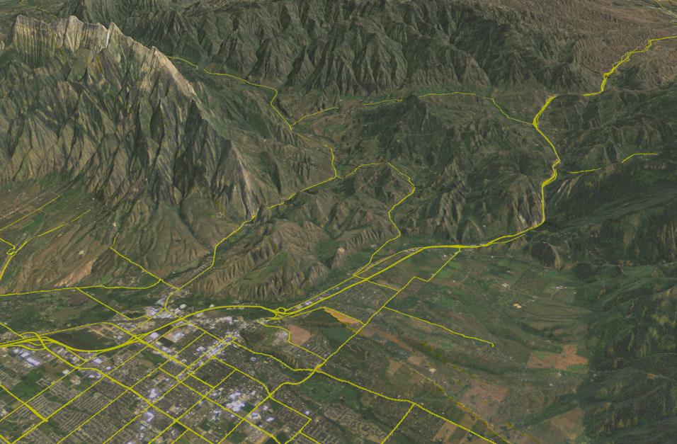
Walla Walla, Washington — USGS 10m DEM, H3 Hexbin
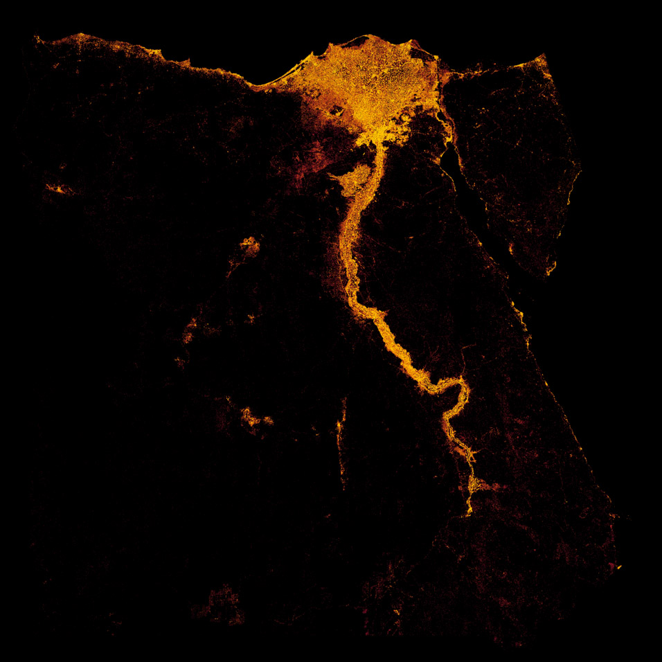
Egypt — Building Footprints, H3 Heatmap
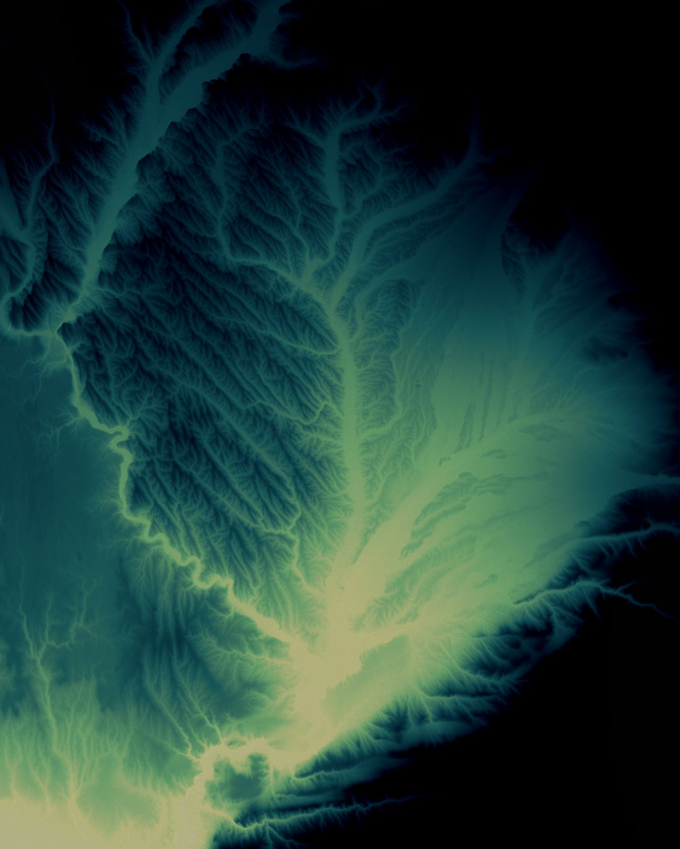
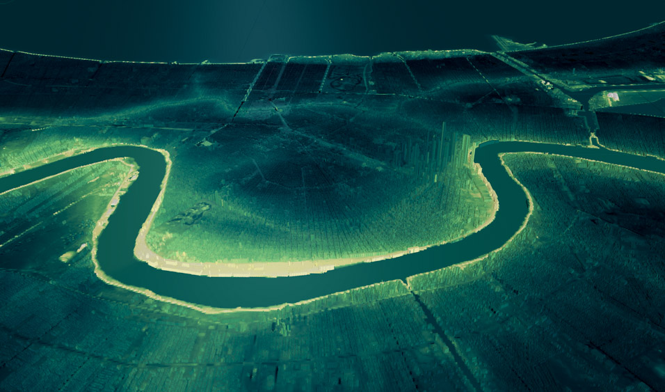
Yazoo Delta, Mississippi — USGS 10m DEM
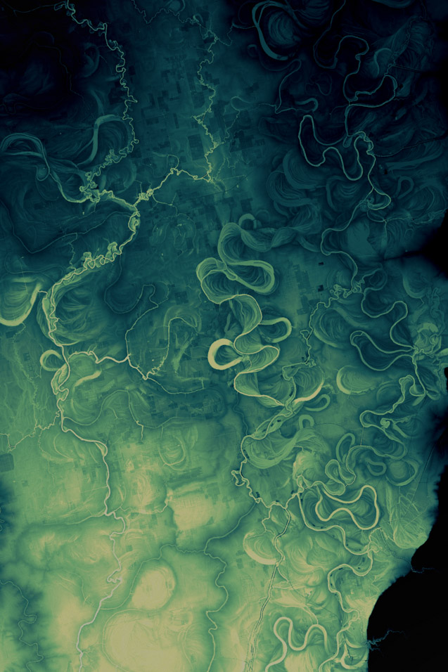
New Orleans — DEM with Overture Buildings, Below Sea Level
Lake Como, Italy — Sentinel-2, H3 DEM
Sentinel-2 Explorer — False Color
Bozeman, Montana — Sentinel-2, Overture Buildings, DEM Slope
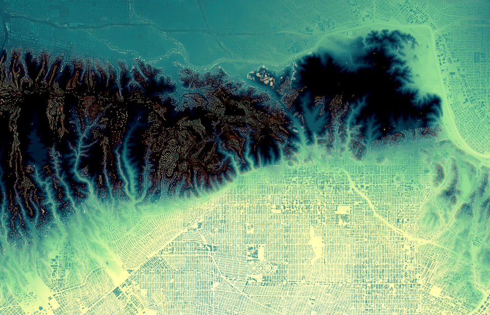
Los Angeles — Overture Buildings, DEM, H3 Elevation Heatmap
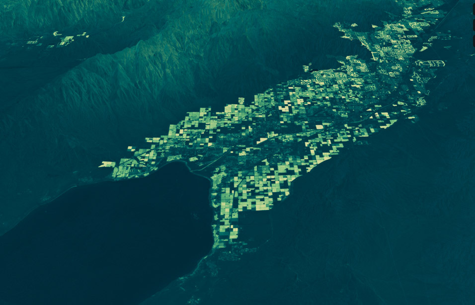
Coachella Valley, California — NDVI, H3 Elevation
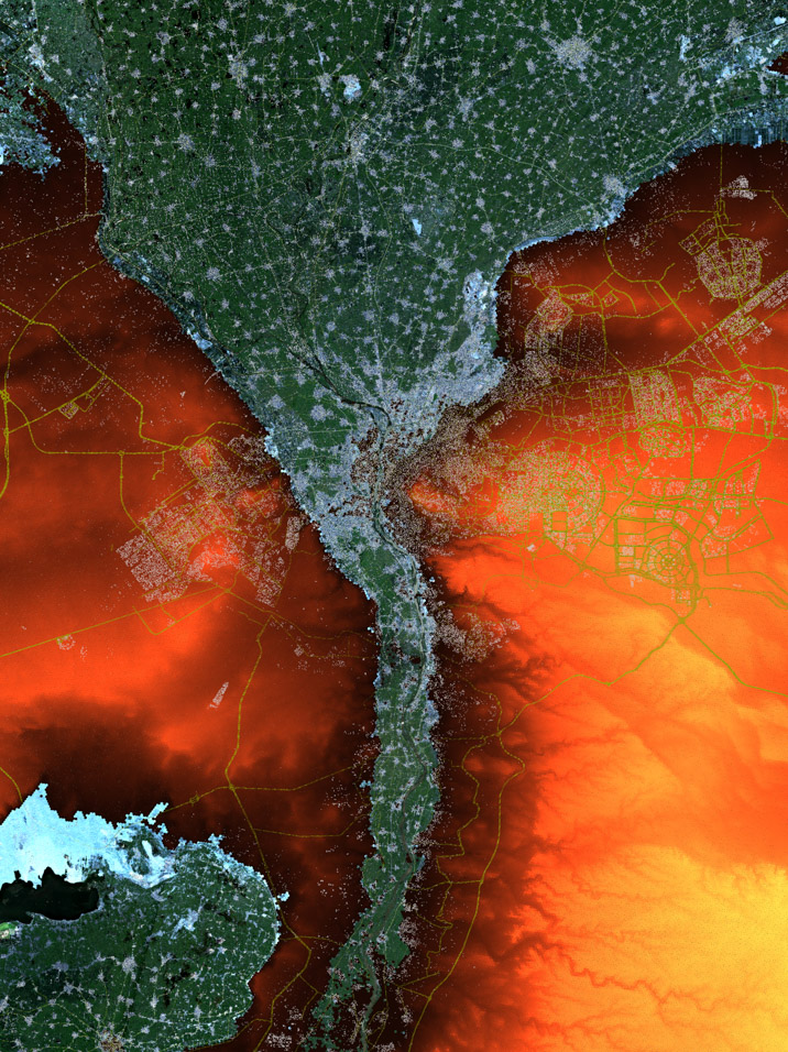
Nile Delta, Egypt — DEM Elevation Threshold, Sentinel-2